
Air Masses & Front
Air mass
Is big blob of air with similar properties
– Usually 1600 km across & Several km thick
FRONTAL PASSAGE Change in weather when one air mass moves out & a new air mass moves in
– Brings changes in T, P, RH, & Winds
Air masses form when they move over large regions that exhibit very similar properties
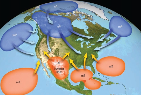
Air mass Source Regions
Polar & Tropical regions tend to exhibit such properties & therefore are good source regions
The mid-latitudes tend to be strongly variable & therefore are not good source regions
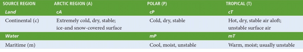
Types of Air masses
Air masses are designated by 2-letter describes basic info about T & RH
– T: Cold (Polar) or warm (Tropical)
– RH: wet (Maritime) or dry (Continental)
Symbols used
Polar (or Cold) → P
Tropical (or warm) → T, (Thenderstorm)
Continental (or dry) → C
Maritime (or humid) → M
Equatorial (from the Equator) → E
Artic (from Artic) → A
Antartic (from Antartic) → AA
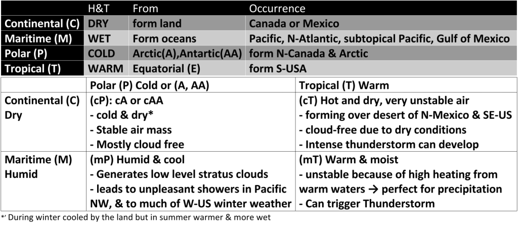
mP = Maritime Polar = Cold & wet
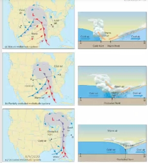
Polar Front Theory (or Norwegian Cyclone Model)
Discovered by Norwegian scientists during World War I
Theory Mid‐Latitude Cyclones (MLCs)
– Develop in conjunction with the Polar Front
– Cold equatorward moving air collides with warm poleward moving air
– The collisions create FRONTS
– In upper atm polar front is continuous
– at the surface polar front is discontinuous
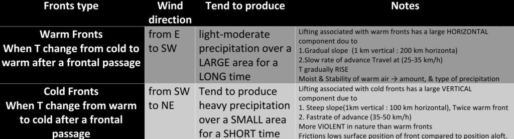
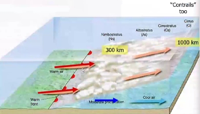
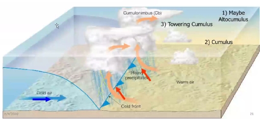
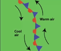
Fronts
Boundaries surfaces that separate air masses of different densities (related to T)
– the barrier that travels with air masses
Can be combinations of warm, cold, dry, moist
Usually 15‐200 km wide bands but narrow
Represented by narrow lines on a map
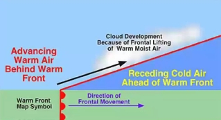
Overrunning: Warmer air (less dense) always moves above cooler air
Ideally the fronts move in approx. the same direction

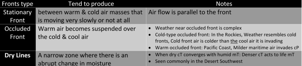
Weather Behind a Cold Front
Weather behind cold fronts is characterized by SUBSIDING air
usually a continental polar (cP) air mass
usually cloudless
generally stable, limits cloud development

The End
